


Language:
Currency:


Atlanterhavsvegen, Nasjonale turistveger
Map of the National Autoturistical Route Atlanterhavsvegen along the bridges and islands on the Atlantic Ocean between Molde and Kristiansund. There are also 5 quality views from this area of Norway. The stacked map is in the hardboard cover. Information in English, Norwegian and German
Kč 659
In Stock

Autoatlas Island 1:150 000
NOVÉ VYDÁNÍ. Automapa celého Islandu, měřítko 1:150 000, listy na spirále. Obsahuje i plány měst, kempy, hřiště, zajímavosti a místa k výhledu. Rozsáhlý rejstřík
Kč 1,098
In Stock

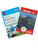
Autoatlas Norsko 1:250 000/1:400 000
NOVÉ VYDÁNÍ. Automapa celého Norska, měřítko 1:250 000 pro jižní část a sever Norska pak 1:400 000, listy na spirále. Obsahuje i plány měst, kempy, hřiště, zajímavosti a místa k výhledu. Rozsáhlý rejstřík i s poštovními kódy (PSČ).
Kč 768
In Stock

Automapa Dánsko, Grónsko, Faerské ostovy 1:400 000
Automapa v měřítku 1 : 400 000 (1 cm = 4 kilometry) zobrazuje síť silnic a dálnic s dopravními vzdálenostmi, dále všechna sídla a vybraný tematický obsah (hrady, zámky, kláštery, kempy apod.). Součástí mapového podkladu jsou lesy a stínovaný terén. Rejstřík sídel naleznete na rubové straně.
Kč 361
Out-of-Stock

Automapa Faerské ostrovy 1:100 000
Jednostranná skládací mapa celých Faerských ostrovů. Podrobná mapa města Tórshavn. Měřítko 1:100 000.
Kč 361
Out-of-Stock

Automapa Jihozápadní Švédsko 1:600 000
Oboustranná skládaná automapa jihozápadního Švédska. Měřítko 1:250 000. Rejstřík míst + plánek center měst Göteborg, Oslo
Kč 361
In Stock

Automapa Švédsko 1:600 000
Oboustranná skládaná automapa celého Švédska. Měřítko 1:600 000. Rejstřík míst + plánek center měst Göteborg, Linköping, Stockholm, Sundsvall, Umeea, Uppsala
Kč 361
In Stock
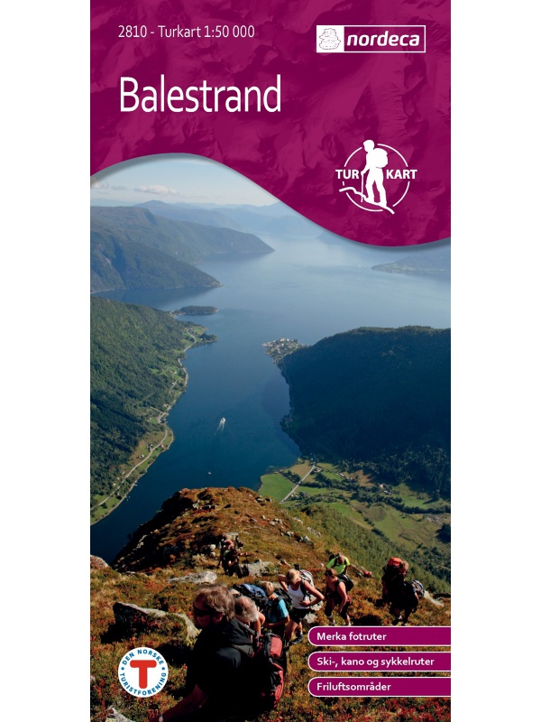
Balestrand Tourist Map 1:50 000
A detailed tourist map of the Sognefjord, includes Balestrand, Vangsnes, Hella, Dragsvik, Gaularfjellet Mountain Road. Detailed map in 1:50 000 scale. Suitable for navigating on and off marked trails. Released in Norway.
Kč 714
In Stock
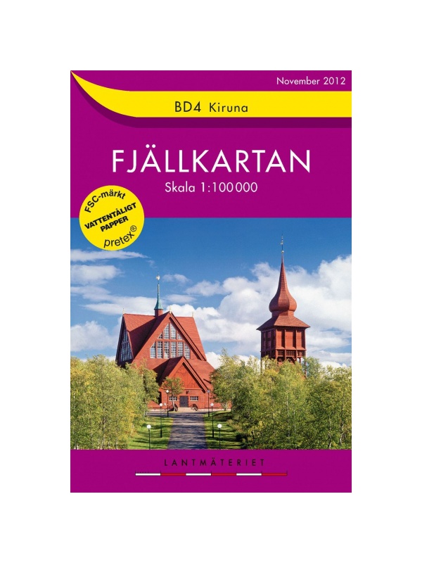
BD4 Kiruna Fjällkarta 1:100.000
A detailed tourist map of the area around the Swedish city of Kiruna. Suitable for tourist guides, travelers and adventurers. Trails for snowmobiles are also marked. The map is printed on paper that resists weather. Texts only in Swedish, clear information and legends in English and German.
Kč 494
zašleme do 24 hodin

BD6 Abisko-Kebnekaise-Narvik 1:100.000
A detailed tourist map of the Swedish National Park Abosko. Suitable for tourist guides, travelers and adventurers. Trails for snowmobiles are also marked. The map is printed on paper that resists weather. Texts only in Swedish, clear information and legends in English and German.
Kč 494
zašleme do 24 hodin

BD8 Kebnekaise - Saltoluokta - Tourist Map 1: 100,000
Detailed tourist map Kebnekaise - Saltoloukta. Suitable for tourist guides, travelers and adventurers. Roads for snowmobiles are also marked. The map is printed on paper that resists weather. Texts only in Swedish, well-arranged information and legend in English and German.
Kč 494
In Stock
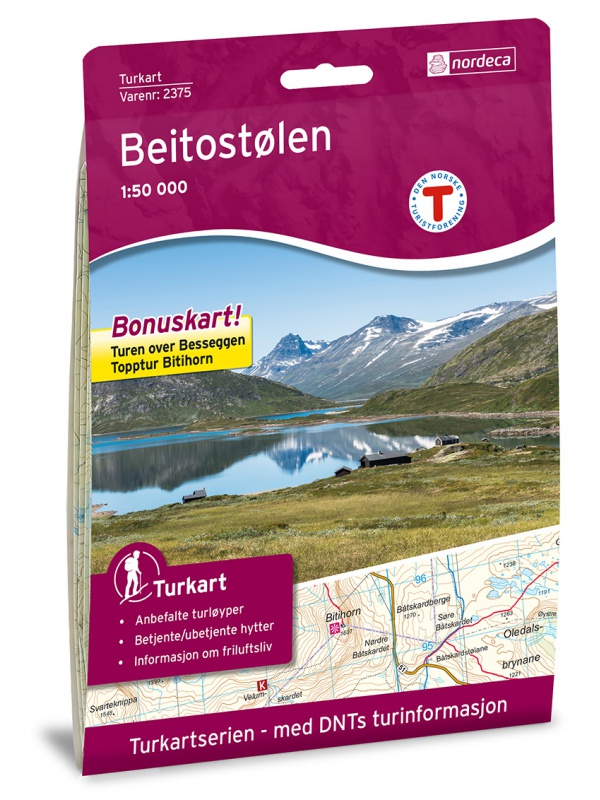
Beitostolen tourist map 1:50 000
Detailed tourist map of the popular area for downhill and cross-country skiers Beitostolen. The bonus map also includes the crossing of the Besseggen ridge and the hike to the Bitihorn mountain in Jotunheimen Park. Detailed map in 1:50 000 scale. Suitable for navigating on and off marked trails. Released in Norway.
Kč 714
In Stock
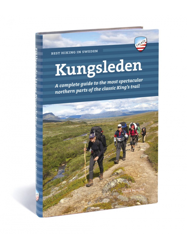
Best hiking in Sweden - KUNGSLEDEN - English
English translation of the book Fjällvandra längs Kungsleden. A complete guide to the most beautiful northern part of the legendary royal route. Describes the route Abisko - Kvikkjokk (English).
Kč 934
Out-of-Stock

Birkebeiner - 1:50.000
A detailed tourist map of the popular Birken (Birkebeiner) from Reny to Lillehammer. The race has its well-known winter version of Birkebeinerrennet, but also cross-country and cycling. Detailed map in 1: 100,000 scale. Detailed mapping of hiking trails and mountain chalets. Suitable for navigation on and off marked roads. Released in Norway.
Kč 659
In Stock
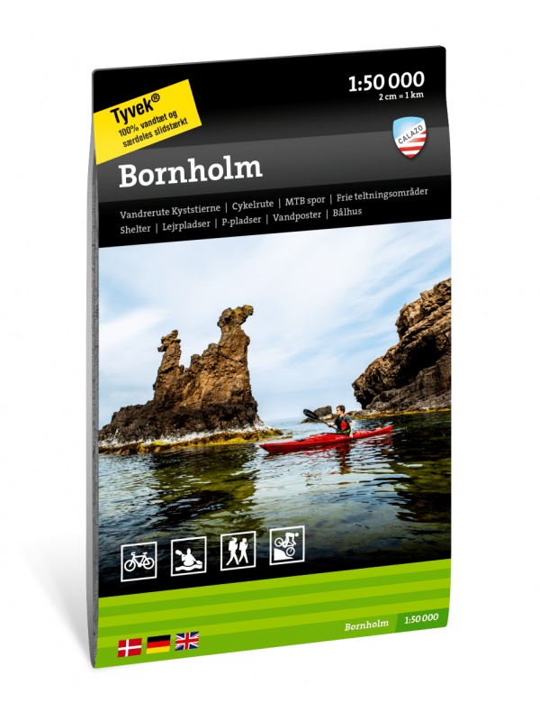
Bornholm 1: 50.000 - Tourist map of the island
Detailed tourist map of the Swedish national park Sarek. Suitable for tourist guides, travelers and adventurers. Roads for snowmobiles are also marked. The map is printed on weather-resistant paper. Texts only in Swedish, clear information and legend also in English and German.
Kč 494
Out-of-Stock

Breheimen nasjonalpark map 1:50 000 TOPO 3000
Detailed tourist map of Breheimen National Park. Includes known areas of Sognefjellet - Galdhopiggen. Made of weather-resistant paper. Double-sided, scale 1:50 000. Includes over 3000 km2. Released in Norway.
Kč 769
In Stock

Car map Finland 1:500,000
The car map on a scale of 1:500,000 (1 cm = 5 kilometers) shows the network of roads and highways with transport distances, as well as all settlements and selected thematic content (castles, chateaux, monasteries, campsites, hotels, etc.). Forests and
Kč 361
In Stock

Car map Norway 1:600,000
Double-sided folded car map of the whole of Norway. Scale 1:600,000. Index of places + city center map of Bergen, Oslo, Trondheim, Narvik, Stavanger, Hammerfest
Kč 361
In Stock