Tourist maps Norway

Turistické mapy Norsko

Chystáte se na trek po norských horách? Vyberte si z našich map, které dovážíme přímo od norských vydavatelů. Především turistické mapy jsou velmi odolné rozmarům počasí. V mapách jsou zakresleny turistické trasy i s časovými údaji. Díky podrobnému měřítku se v horách už neztratíte.

Turistické mapy Norsko

Grid
List

There are 40 products.

Showing 1-20 of 40 item(s)

Active filters

  • Availability: In stock

Valdresflye, Nasjonale turistveger

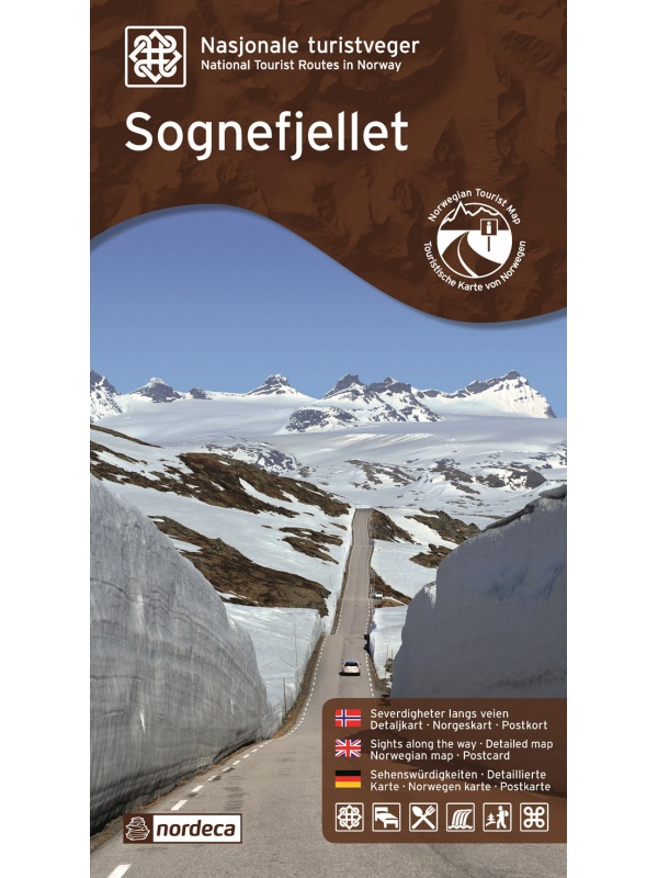
Map of the National Autoturist Route through the Valdresfly Pass at a scale of 1: 50,000. There are also 5 quality views from this area of ​​Norway. The stacked map is in the hardboard cover. Information in English, Norwegian and German.
Kč 659
In Stock
View Detail

Turkart Senja - tourist map 1:50,000

This double-sided tourist map covers the entire island of Senja with its high, steep mountains and typical alpine feel. It is part of Calazo's modern map series with unique terrain information based on laser scanning from aircraft. Thanks to the Tyvek® material, it is completely waterproof and highly tear-resistant.
Kč 549
In Stock
View Detail

Trondheim 1:50.000

Detailed map of Trondheim and region. Detailed map in 1:50 000 scale. Detailed mapping of hiking trails and mountain chalets. Suitable for navigation on and off marked roads. Released in Norway.
Kč 659
zašleme do 24 hodin
View Detail

Trolltunga, Odda - Ullensvang 1:50.000

Detailed map of Trolltunga, Odda - Ullensvang. Detailed map in 1:50 000 scale. Detailed mapping of hiking trails and mountain chalets. Suitable for navigation on and off marked roads. Released in Norway.
Kč 714
zašleme do 24 hodin
View Detail

Tourist map Romsdalseggen 1:25 000

The most detailed tourist map of Romsdalseggen, includes Trollstigen, Trollveggen, Romsdalshornet, Andaslnes, Isfjorden Detailed map in 1:25 000 scale. Suitable for navigating on and off marked trails. Released in Norway.
Kč 714
In Stock
View Detail

Tourist Map Breheimen 1: 50.000

Detailed tourist map of the Breheimen National Park. Detailed map in 1:50 000 scale. Detailed mapping of hiking trails and mountain chalets. Suitable for navigation on and off marked roads. Released in Norway.
Kč 659
In Stock
View Detail

Rondane, Nasjonale turistveger

Map of the National Autoturist Route through the Rondane National Park at a scale of 1: 55,000. There are also 5 quality views from this area of ​​Norway. The stacked map is in the hardboard cover. Information in English, Norwegian and German.
Kč 659
In Stock
View Detail

Rallarvegen 1:50.000

Detailed tourist and cycle map of the Rallarvegen area. Detailed map in 1:50 000 scale. Detailed mapping of hiking trails and mountain chalets. Suitable for navigation on and off marked roads. Released in Norway.
Kč 659
zašleme do 24 hodin
View Detail

Oyer - Lillehammer 1:50.000

Detailed map of Oyer - Lillehammer. Detailed map in 1:50 000 scale. Detailed mapping of hiking trails and mountain chalets. Suitable for navigation on and off marked roads. Released in Norway.
Kč 659
zašleme do 24 hodin
View Detail

Nordkinnhalvoya - tourist map 1:60,000

Tourist map of the northernmost peninsula of mainland Europe, Nordkinnhalvoya, and the Finnmark region. A good hiking map is a great helper when planning nice hikes in the Finnmark region. Texts only in Norwegian, clear information and legend also in English. Thanks to the Tyvek® material, it is completely waterproof and highly tear-resistant.
Kč 549
In Stock
View Detail

Mapa Aurlandsfjellet, Nasjonale turistveger

Aurlandsfjellet National Road Map (Route No. 243) at a scale of 1: 50,000. It features famous places like Stegastein, Naeroeyfjord, the Laerdal tunnel. There are also 5 quality views from this area of ​​Norway. The stacked map is in the hardboard cover. Information in English, Norwegian and German.
Kč 659
In Stock
View Detail