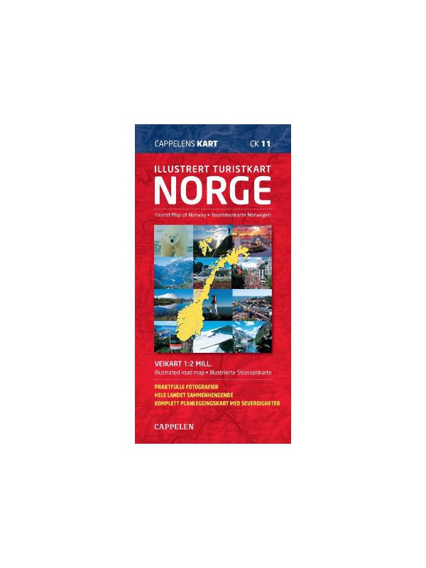
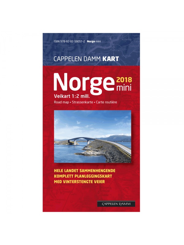
Special maps Norway

Speciální mapy Norsko

Seženeme vám mapy těch nejzapadlejších koutů Norska. Pokud je nemáme v nabídce, napište nám a dovezeme vám ji.

Speciální mapy Norsko

Grid
List

There are 36 products.

Showing 1-20 of 36 item(s)

CK52 Lofoten 1:220.000 - road map

A detailed car map of Lofoten archipelago and the western part of the Vesterala archipelago. Detailed maps of cities and places of interest in a scale of 1: 15,000. Map at 1: 220,000 scale. Suitable for navigation on and off marked roads. Released in Norway. Explanations in Norwegian, English and German.
Kč 659
Out-of-Stock

Experience Guide South Norway 1: 250,000, Opplevelsesguide

Map with tips for the southernmost part of Norway from the E39 and E18 along the coast from Tonsberg to Kristiansadn to Stavanger. It ends under the Hardangervidda National Park. One in a scale of 1: 250,000. The stacked map contains tips on places of interest with information and contacts. Labels in English, Norwegian and German.
Kč 659
Out-of-Stock

Experienced Guide to Gudbrandsdalen 1:250 000,...

Map with tips for the longest valley of central Norway in one on a scale of 1: 250,000. The stacked map contains tips on places of interest with information and contacts. Includes the area part along the E6 Hamar - Dombas Road, and the Osterdalen Elverum - Alvdal Road No. 3 and the Sognefjellet and Filefjell Highways. Labels in English, Norwegian and German.
Kč 659
Out-of-Stock

Experienced Guide to Western Norway 1: 250,000,...

Map with tips for the west coast of Norway in one on a scale of 1: 250,000. The stacked map contains tips on places of interest with information and contacts. Includes coastal road E39 - Bergen - Alesund and Bergen - Voss - Sogndal to Jolster. Labels in English, Norwegian and German.
Kč 659
Out-of-Stock

Experienced Guide to Southwest Norway 1: 250,000,...

Map with tips for southwest Norway in one on a scale of 1: 250,000. The stacked map contains tips on places of interest as well as information and contacts. Jaren and Stavanger via Haugesund to Bergen, from Ryfylke and Hardanger to Vosse, through Setesdal, to Haukeli and Roldal. Labels in English, Norwegian and German.
Kč 659
Out-of-Stock

Experienced Guide to Lofoten 1:250 000, Opplevelsesguide

Map with tips for Lofoten in one on a scale of 1: 250,000. The folded map contains tips on interesting places on Lofotech with information and contacts. The area from Bodo via Salten, Rognan and Fauske, Ofoten with Narvik, Vesteralen - Andoya and Lofoten up to the village A. Labels in English, Norwegian and German.
Kč 659
Out-of-Stock

Trolltunga, Odda - Ullensvang 1:50.000

Detailed map of Trolltunga, Odda - Ullensvang. Detailed map in 1:50 000 scale. Detailed mapping of hiking trails and mountain chalets. Suitable for navigation on and off marked roads. Released in Norway.
Kč 714
zašleme do 24 hodin
View Detail

Balestrand Tourist Map 1:50 000

A detailed tourist map of the Sognefjord, includes Balestrand, Vangsnes, Hella, Dragsvik, Gaularfjellet Mountain Road. Detailed map in 1:50 000 scale. Suitable for navigating on and off marked trails. Released in Norway.
Kč 714
In Stock
View Detail

Hurrungane Tourist Map 1: 25.000

Detailed tourist map of Hurrungane mountains in the Jotunheimen park area near the 55 Sognefjellet road. Includes Fannaraki Glacier, Sognefjellshytta, Fannarakhytta, Grandalen, Ingjerdbu, Vettli Gard. Detailed map in 1:25 000 scale. Suitable for navigating on and off marked trails. Released in Norway.
Kč 714
In Stock
View Detail

Tourist map Romsdalseggen 1:25 000

The most detailed tourist map of Romsdalseggen, includes Trollstigen, Trollveggen, Romsdalshornet, Andaslnes, Isfjorden Detailed map in 1:25 000 scale. Suitable for navigating on and off marked trails. Released in Norway.
Kč 714
In Stock
View Detail

Rallarvegen 1:50.000

Detailed tourist and cycle map of the Rallarvegen area. Detailed map in 1:50 000 scale. Detailed mapping of hiking trails and mountain chalets. Suitable for navigation on and off marked roads. Released in Norway.
Kč 659
zašleme do 24 hodin
View Detail

Hiking map Lysefjorden 1:50.000

Detailed tourist map of Lysefjorden, Preikestolen, Kjerag, etc. Detailed map in 1:50 000 scale. Detailed map of hiking trails and mountain chalets. Suitable for navigation on and off marked roads. Released in Norway.
Kč 714
Out-of-Stock

Trondheim 1:50.000

Detailed map of Trondheim and region. Detailed map in 1:50 000 scale. Detailed mapping of hiking trails and mountain chalets. Suitable for navigation on and off marked roads. Released in Norway.
Kč 659
zašleme do 24 hodin
View Detail