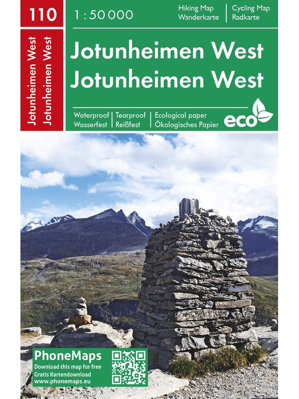
Jotunheimen West - tourist map 1:50 000 Phone Maps

Detailed tourist map of the western part of the Norwegian Jotunheimen National Park and the southern and central part of the Breiheimen National Park. Made of weather-resistant paper. Scale 1:50 000. You can upload the map for free to your mobile phone using PhoneMaps!
Kč 439
In Stock
View Detail

Map of Nordkapp - Norge Serien 1:50 000

Map of Nordkappa, the northernmost Cape of Norway on the island of Mageroya. contains the town of Honningsvag, the fishing villages kamoyvaer, Gjervaer, Skarsvag and the route to Knivskjelodden. Detailed scale 1:50 000.
Kč 769
In Stock
View Detail

Nordkinnhalvoya - tourist map 1:60,000

Tourist map of the northernmost peninsula of mainland Europe, Nordkinnhalvoya, and the Finnmark region. A good hiking map is a great helper when planning nice hikes in the Finnmark region. Texts only in Norwegian, clear information and legend also in English. Thanks to the Tyvek® material, it is completely waterproof and highly tear-resistant.
Kč 549
In Stock
View Detail

Autoatlas Norsko 1:250 000/1:400 000

NOVÉ VYDÁNÍ. Automapa celého Norska, měřítko 1:250 000 pro jižní část a sever Norska pak 1:400 000, listy na spirále. Obsahuje i plány měst, kempy, hřiště, zajímavosti a místa k výhledu. Rozsáhlý rejstřík i s poštovními kódy (PSČ).
Kč 768
In Stock
View Detail

Veikart Norge 1:1mil. - map of Norway

Norwegian folding car park and the Spitsbergen archipelago with a rich register of places on the back. The latest edition of the Road Statement to the beginning of 2017. Table of Distances. Labels in Norwegian, English and German. Scale 1: 1 mil.
Kč 659
zašleme do 24 hodin
View Detail

Roadmap Norway 2016 1:1,1 mil. CK13 Hele Norge

Norwegian folding car park and the Spitsbergen archipelago with a rich register of places on the back. The latest edition of the Road Statement to Begin 2016. The Distance Table. Labels in Norwegian, English and German. Scale 1: 1.1 million
Kč 714
zašleme do 24 hodin
View Detail

Turkart Rondane - tourist map 1:50,000

This double-sided hiking map covers the whole of Norway's oldest national park, Rondane, with classic hiking destinations such as Rondvassbu, Bjornhollia, Rondeslottet (2178 nm) and Hogronden (2115 nm). The map covers all the most popular mountain areas, marked hiking trails in the vicinity, DNT cabins and private accommodation cabins. It shows marked...
Kč 549
Out-of-Stock

Hoyfjellskart Lofoten: Moskenes - tourist map Lofoten...

One of three unique maps with lots of details that have never been shown on a Lofoten map. The terrain information on the map is based on a laser scan from an airplane. For the first time, mountain slopes, larger rocks, streams and glaciers appear with an accuracy that corresponds to reality. The 1:30,000 scale map provides good support for those who go...
Kč 549
Out-of-Stock

OSLO city center map - OSLO sentrum CK59, 1: 4000, 1: 7000

A detailed map of Oslo city center suitable for hikers. It contains all public transport stations, important shops, monuments and important places. Scale 1: 7,000, Aker Brygge area and center 1: 400. On the back is also well-arranged map of public transport in scale 1: 40.000 and list of restaurants. There is a street index. Published in Norway.
Kč 439
Out-of-Stock