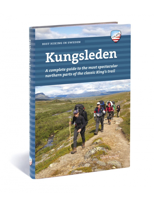
Grid
List

There are 38 products.

Showing 21-38 of 38 item(s)

Comprehensive map of Sweden - Sverige med rasteplasser...

A simplified map of Sweden with roads, distances and landscape boundaries at a scale of 1:1.2 mil. Developed together with M-Sverige with the Tafikverket agency's database of Swedish rest areas. A total of 313 rest areas are marked on the map and named in the register. Traffic maps of Stockholm, Gothenburg and Malmö. Published in Sweden, information in...
Kč 197
In Stock
View Detail

Kungsleden: Kvikkjokk–Adolfström - tourist map 1:50,000

Tourist map of part of the Kungsleden (King's trail) hiking trail in northern Sweden, approximately 440 kilometers long, between Abisko National Park in the north and Hemavan in the south. Thanks to the Tyvek® material, it is completely waterproof and highly tear-resistant. Tyvek will not wear out in the crease or lose color with use.
Kč 549
In Stock
View Detail

Högalpin card Kebnekaise - tourist map 1:15,000

This is a unique map with many details that have never been shown on a map of Sweden's highest mountain. Map terrain information is based on aerial laser scanning. For the first time, cliffs, larger rocks, forests and waterways appear with true-to-life accuracy. The current extent of the glaciers and the fracture zones were created in collaboration with...
Kč 494
In Stock
View Detail

Mapa celého Švédska 1:800 000 - Sverige Easy Map

Jednostranná turistická mapa obsahující turistické a cykloturistické značení, dále zaznačeny tábořiště, kempy, kostely, turistická informační centra, hranice NP, kulturní a historické památky. Nejzajímavější lokality jsou označeny číslem a samostatně popsány na rubové straně v textové části (švédsky, anglicky, německy). měřítko 1:800 000
Kč 351
In Stock
View Detail

Norra Gotland + Faro 1:60,000 - tourist map of the island

The 1:60,000 waterproof terrain map of Norra Gotland and Faro is perfect for those of you who are hiking or cycling on the island, or if you just want to find your way down by car to one of the semi-secret beaches. The southern part of the island of Gotland can be found under the name Sodra Gotland.
Kč 494
In Stock
View Detail

Sodra Gotland 1:60,000 - tourist map of the island

The 1:60,000 scale waterproof terrain map of Sodra Gotland is perfect for those of you who are hiking or cycling on the island, or if you just want to find your way down by car to one of the semi-secret beaches. The northern part of Gotland + Faro can be found under the name Norra Gotland + Faro.
Kč 494
In Stock
View Detail