Maps Norway

Norsko

Do Norska jedině s mapou od nás. Dovážíme přesné a podrobné mapy vydané v Norsku. Obsahují aktuální stavy silnic i plánované nové úseky. Dovíte se kde je třeba zastavit a kudy povede trasa vašeho výletu.

Norsko

Grid
List

There are 103 products.

Showing 1-20 of 103 item(s)

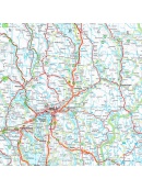
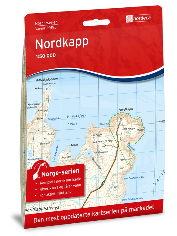
Map of Nordkapp - Norge Serien 1:50 000

Map of Nordkappa, the northernmost Cape of Norway on the island of Mageroya. contains the town of Honningsvag, the fishing villages kamoyvaer, Gjervaer, Skarsvag and the route to Knivskjelodden. Detailed scale 1:50 000.
Kč 769
In Stock
View Detail

Bergen - 7 fjellsturen - 1:25.000

A detailed tourist map of the popular march over 7 peaks around Bergen - Bergen - 7 fjellsturen. Detailed map at 1:25 000. Released in Norway. Explanations in Norwegian and English. Summary information about the map in English.
Kč 659
Out-of-Stock

Folgefonna - Hardangerfjorden 1:100.000

Detailed tourist map of Folgefonna National Park and the glaciers of the Hardanger Fjord. Detailed map in 1: 100,000 scale. Detailed mapping of hiking trails and mountain chalets. Suitable for navigation on and off marked roads. Released in Norway.
Kč 659
Out-of-Stock

Beitostolen tourist map 1:50 000

Detailed tourist map of the popular area for downhill and cross-country skiers Beitostolen. The bonus map also includes the crossing of the Besseggen ridge and the hike to the Bitihorn mountain in Jotunheimen Park. Detailed map in 1:50 000 scale. Suitable for navigating on and off marked trails. Released in Norway.
Kč 714
In Stock
View Detail

Autoatlas Norsko 1:250 000/1:400 000

NOVÉ VYDÁNÍ. Automapa celého Norska, měřítko 1:250 000 pro jižní část a sever Norska pak 1:400 000, listy na spirále. Obsahuje i plány měst, kempy, hřiště, zajímavosti a místa k výhledu. Rozsáhlý rejstřík i s poštovními kódy (PSČ).
Kč 768
In Stock
View Detail

Lofoten 1:100.000

A detailed tourist map of the Lofoten archipelago. Detailed map in 1: 100,000 scale. Detailed mapping of hiking trails and mountain chalets. Suitable for navigation on and off marked roads. Released in Norway.
Kč 714
Out-of-Stock

Tourist Map Besseggen 1: 25.000

Detailed tourist map of the Bessegen ridge in Jotunheimen Park. A detailed map in the 1:25 000 scale. Winter skiing routes are also marked. Suitable for navigation on and off marked roads. Released in Norway.
Kč 659
Out-of-Stock

Galdhopiggen 1:25.000, hiking map

Detailed tourist map of the highest mountain Scandinavia Galdhopiggen in Jotunheimen Park. Drawn access roads from the catchment of Juvasshytta and the village of Spiterstulen. A detailed map in the 1:25 000 scale. Winter skiing routes are also marked. Suitable for navigation on and off marked roads. Released in Norway.
Kč 659
In Stock
View Detail

Veibok Norge 2018 1:250 000/1:500 000, road atlas

Autoatlas on a spiral in a detailed scale of 1: 250,000 for the southern part after Trondheim and 1: 500,000 north of Norway to Nordkapp and the border with Russia. Including pumping and charging stations, ferry connections, new and planned tunnels and bridges, tourist cottages. Rich site index. The latest edition of Road Statements to Begin 2018....
Kč 1,374
Out-of-Stock

Hiking map Romsdalen 1:100.000

A detailed tourist map of the Romsdalen valley, including popular Trollveggen, Trollstigen, Geirangerfjord, and NP Reinheimen. Detailed map in 1: 100,000 scale. Detailed mapping of hiking trails and mountain chalets. Suitable for navigation on and off marked roads. Released in Norway.
Kč 659
Out-of-Stock

Tourist Map Breheimen 1: 50.000

Detailed tourist map of the Breheimen National Park. Detailed map in 1:50 000 scale. Detailed mapping of hiking trails and mountain chalets. Suitable for navigation on and off marked roads. Released in Norway.
Kč 659
In Stock
View Detail

Great Atlas NORWAY CK14 - Bilatlas NORGE 2019

Detailed road Atlas of Norway. The latest edition, as of the end of 2018. New roads, all ferries, accommodation offers, points of interest, outlooks, sights. 75 city plans. Also suitable for hiking trips, marked paths and walking tours. Selected tourist cottages DNT.
Kč 1,309
Out-of-Stock

Tourist map Romsdalseggen 1:25 000

The most detailed tourist map of Romsdalseggen, includes Trollstigen, Trollveggen, Romsdalshornet, Andaslnes, Isfjorden Detailed map in 1:25 000 scale. Suitable for navigating on and off marked trails. Released in Norway.
Kč 714
In Stock
View Detail

Birkebeiner -  1:50.000

A detailed tourist map of the popular Birken (Birkebeiner) from Reny to Lillehammer. The race has its well-known winter version of Birkebeinerrennet, but also cross-country and cycling. Detailed map in 1: 100,000 scale. Detailed mapping of hiking trails and mountain chalets. Suitable for navigation on and off marked roads. Released in Norway.
Kč 659
In Stock
View Detail

MC Kart Norge - Norway map for bikers

Well-organized map of Norway for bikers. 8 separate sheets, each for a different part of Norway. The latest edition, as of 2019. New roads, all ferries, accommodation offers, points of interest, views, landmarks. 75 city plans. Also suitable for hiking trips, marked paths and walking tours. Selected tourist cottages DNT.
Kč 869
Out-of-Stock

Oyer - Lillehammer 1:50.000

Detailed map of Oyer - Lillehammer. Detailed map in 1:50 000 scale. Detailed mapping of hiking trails and mountain chalets. Suitable for navigation on and off marked roads. Released in Norway.
Kč 659
zašleme do 24 hodin
View Detail

Hurrungane Tourist Map 1: 25.000

Detailed tourist map of Hurrungane mountains in the Jotunheimen park area near the 55 Sognefjellet road. Includes Fannaraki Glacier, Sognefjellshytta, Fannarakhytta, Grandalen, Ingjerdbu, Vettli Gard. Detailed map in 1:25 000 scale. Suitable for navigating on and off marked trails. Released in Norway.
Kč 714
In Stock
View Detail