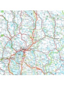
Maps Norway

Norsko

Do Norska jedině s mapou od nás. Dovážíme přesné a podrobné mapy vydané v Norsku. Obsahují aktuální stavy silnic i plánované nové úseky. Dovíte se kde je třeba zastavit a kudy povede trasa vašeho výletu.

Norsko

Active filters

  • Availability: Not available

Turkart Rondane - tourist map 1:50,000

This double-sided hiking map covers the whole of Norway's oldest national park, Rondane, with classic hiking destinations such as Rondvassbu, Bjornhollia, Rondeslottet (2178 nm) and Hogronden (2115 nm). The map covers all the most popular mountain areas, marked hiking trails in the vicinity, DNT cabins and private accommodation cabins. It shows marked...
Kč 549
Out-of-Stock

Hoyfjellskart Lofoten: Moskenes - tourist map Lofoten...

One of three unique maps with lots of details that have never been shown on a Lofoten map. The terrain information on the map is based on a laser scan from an airplane. For the first time, mountain slopes, larger rocks, streams and glaciers appear with an accuracy that corresponds to reality. The 1:30,000 scale map provides good support for those who go...
Kč 549
Out-of-Stock

OSLO city center map - OSLO sentrum CK59, 1: 4000, 1: 7000

A detailed map of Oslo city center suitable for hikers. It contains all public transport stations, important shops, monuments and important places. Scale 1: 7,000, Aker Brygge area and center 1: 400. On the back is also well-arranged map of public transport in scale 1: 40.000 and list of restaurants. There is a street index. Published in Norway.
Kč 439
Out-of-Stock

Map of Norway 1: 800 000 - Norge Easy Map

One-sided tourist map with hiking and biking trails, camping sites, camps, churches, tourist information centers, NP borders, cultural and historical monuments. The most interesting sites are marked with a number and separately described on the reverse side of the text (Swedish, English, German). scale 1: 800,000
Kč 351
Out-of-Stock

Lysefjorden 1:50 000 TOPO 3000

Detailed map of Lysefjorden and places of interest, including Preikestolen - Lysebotn - Sandnes ost - Frafjord, Kjerag and more. Made of weather-resistant paper. Double-sided, scale 1:50 000. Includes over 3000 km2. Released in Norway.
Kč 769
Out-of-Stock

Experience Guide South Norway 1: 250,000, Opplevelsesguide

Map with tips for the southernmost part of Norway from the E39 and E18 along the coast from Tonsberg to Kristiansadn to Stavanger. It ends under the Hardangervidda National Park. One in a scale of 1: 250,000. The stacked map contains tips on places of interest with information and contacts. Labels in English, Norwegian and German.
Kč 659
Out-of-Stock

Folgefonna 1:50 000 TOPO 3000

Detailed tourist map of the Folgefonna glacier and the surrounding area, including places like Tyssedal, Trolltunga and others. Made of weather-resistant paper. Double-sided, scale 1:50 000. Includes over 3000 km2. Released in Norway.
Kč 769
Out-of-Stock

CK52 Lofoten 1:220.000 - road map

A detailed car map of Lofoten archipelago and the western part of the Vesterala archipelago. Detailed maps of cities and places of interest in a scale of 1: 15,000. Map at 1: 220,000 scale. Suitable for navigation on and off marked roads. Released in Norway. Explanations in Norwegian, English and German.
Kč 659
Out-of-Stock

Experienced Guide to Gudbrandsdalen 1:250 000,...

Map with tips for the longest valley of central Norway in one on a scale of 1: 250,000. The stacked map contains tips on places of interest with information and contacts. Includes the area part along the E6 Hamar - Dombas Road, and the Osterdalen Elverum - Alvdal Road No. 3 and the Sognefjellet and Filefjell Highways. Labels in English, Norwegian and German.
Kč 659
Out-of-Stock