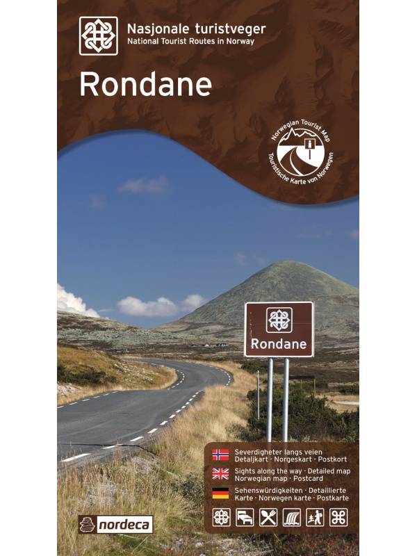
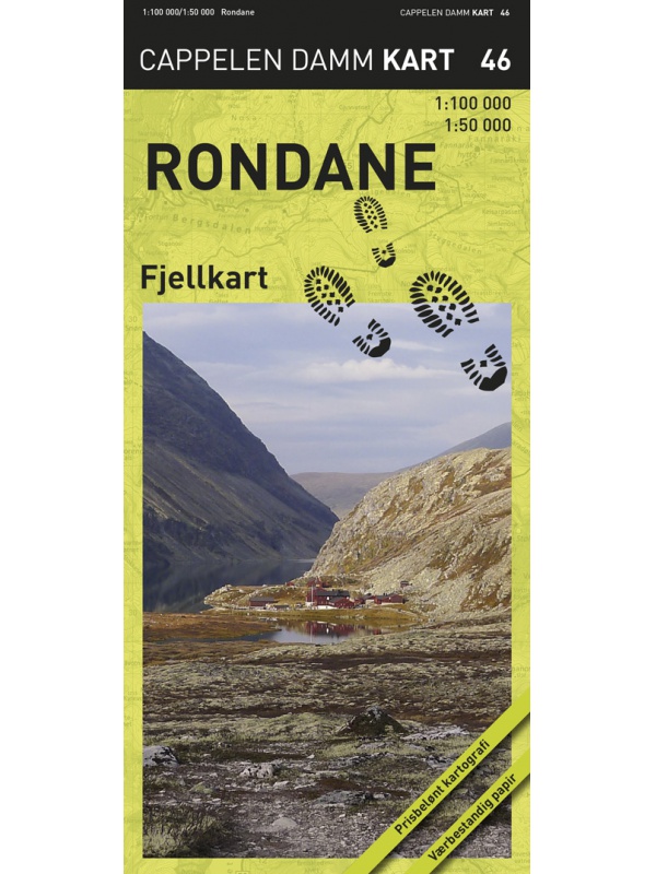
Grid
List

There are 82 products.

Showing 21-40 of 82 item(s)

Map of Nordkapp - Norge Serien 1:50 000

Map of Nordkappa, the northernmost Cape of Norway on the island of Mageroya. contains the town of Honningsvag, the fishing villages kamoyvaer, Gjervaer, Skarsvag and the route to Knivskjelodden. Detailed scale 1:50 000.
Kč 769
In Stock
View Detail

Galdhopiggen 1:25.000, hiking map

Detailed tourist map of the highest mountain Scandinavia Galdhopiggen in Jotunheimen Park. Drawn access roads from the catchment of Juvasshytta and the village of Spiterstulen. A detailed map in the 1:25 000 scale. Winter skiing routes are also marked. Suitable for navigation on and off marked roads. Released in Norway.
Kč 659
In Stock
View Detail

Experience Guide South Norway 1: 250,000, Opplevelsesguide

Map with tips for the southernmost part of Norway from the E39 and E18 along the coast from Tonsberg to Kristiansadn to Stavanger. It ends under the Hardangervidda National Park. One in a scale of 1: 250,000. The stacked map contains tips on places of interest with information and contacts. Labels in English, Norwegian and German.
Kč 659
Out-of-Stock

Mapa Aurlandsfjellet, Nasjonale turistveger

Aurlandsfjellet National Road Map (Route No. 243) at a scale of 1: 50,000. It features famous places like Stegastein, Naeroeyfjord, the Laerdal tunnel. There are also 5 quality views from this area of ​​Norway. The stacked map is in the hardboard cover. Information in English, Norwegian and German.
Kč 659
In Stock
View Detail

CK52 Lofoten 1:220.000 - road map

A detailed car map of Lofoten archipelago and the western part of the Vesterala archipelago. Detailed maps of cities and places of interest in a scale of 1: 15,000. Map at 1: 220,000 scale. Suitable for navigation on and off marked roads. Released in Norway. Explanations in Norwegian, English and German.
Kč 659
Out-of-Stock

Experienced Guide to Gudbrandsdalen 1:250 000,...

Map with tips for the longest valley of central Norway in one on a scale of 1: 250,000. The stacked map contains tips on places of interest with information and contacts. Includes the area part along the E6 Hamar - Dombas Road, and the Osterdalen Elverum - Alvdal Road No. 3 and the Sognefjellet and Filefjell Highways. Labels in English, Norwegian and German.
Kč 659
Out-of-Stock

Experienced Guide to Western Norway 1: 250,000,...

Map with tips for the west coast of Norway in one on a scale of 1: 250,000. The stacked map contains tips on places of interest with information and contacts. Includes coastal road E39 - Bergen - Alesund and Bergen - Voss - Sogndal to Jolster. Labels in English, Norwegian and German.
Kč 659
Out-of-Stock

Experienced Guide to Southwest Norway 1: 250,000,...

Map with tips for southwest Norway in one on a scale of 1: 250,000. The stacked map contains tips on places of interest as well as information and contacts. Jaren and Stavanger via Haugesund to Bergen, from Ryfylke and Hardanger to Vosse, through Setesdal, to Haukeli and Roldal. Labels in English, Norwegian and German.
Kč 659
Out-of-Stock

Experienced Guide to Lofoten 1:250 000, Opplevelsesguide

Map with tips for Lofoten in one on a scale of 1: 250,000. The folded map contains tips on interesting places on Lofotech with information and contacts. The area from Bodo via Salten, Rognan and Fauske, Ofoten with Narvik, Vesteralen - Andoya and Lofoten up to the village A. Labels in English, Norwegian and German.
Kč 659
Out-of-Stock

Veikart Nord-Norge Nord 1:500 000

The last 5th part of north Norway's folding automapap (northern part) with a rich register of places on the back. Includes areas and cities of Tromso, Alta, Hammerfest, Honningsvag, Nordkapp, Vardo, Kirkenes. The latest edition of the Road Statement to Begin 2016. The Distance Table. Labels in Norwegian, English and German. Scale 1: 500,000.
Kč 659
zašleme do 24 hodin
View Detail

Veikart Norge 1:1mil. - map of Norway

Norwegian folding car park and the Spitsbergen archipelago with a rich register of places on the back. The latest edition of the Road Statement to the beginning of 2017. Table of Distances. Labels in Norwegian, English and German. Scale 1: 1 mil.
Kč 659
zašleme do 24 hodin
View Detail

Rallarvegen 1:50.000

Detailed tourist and cycle map of the Rallarvegen area. Detailed map in 1:50 000 scale. Detailed mapping of hiking trails and mountain chalets. Suitable for navigation on and off marked roads. Released in Norway.
Kč 659
zašleme do 24 hodin
View Detail

Trondheim 1:50.000

Detailed map of Trondheim and region. Detailed map in 1:50 000 scale. Detailed mapping of hiking trails and mountain chalets. Suitable for navigation on and off marked roads. Released in Norway.
Kč 659
zašleme do 24 hodin
View Detail

Oyer - Lillehammer 1:50.000

Detailed map of Oyer - Lillehammer. Detailed map in 1:50 000 scale. Detailed mapping of hiking trails and mountain chalets. Suitable for navigation on and off marked roads. Released in Norway.
Kč 659
zašleme do 24 hodin
View Detail

Birkebeiner -  1:50.000

A detailed tourist map of the popular Birken (Birkebeiner) from Reny to Lillehammer. The race has its well-known winter version of Birkebeinerrennet, but also cross-country and cycling. Detailed map in 1: 100,000 scale. Detailed mapping of hiking trails and mountain chalets. Suitable for navigation on and off marked roads. Released in Norway.
Kč 659
In Stock
View Detail

Atlanterhavsvegen, Nasjonale turistveger

Map of the National Autoturistical Route Atlanterhavsvegen along the bridges and islands on the Atlantic Ocean between Molde and Kristiansund. There are also 5 quality views from this area of ​​Norway. The stacked map is in the hardboard cover. Information in English, Norwegian and German
Kč 659
In Stock
View Detail

Helgelandskysten, Nasjonale turistveger

Map of the National Car Travel Route along the coast along Route 17 - Helgelandskysten on a scale of 1: 250,000. There are also 5 quality views from this area of ​​Norway. The stacked map is in the hardboard cover. Information in English, Norwegian and German.
Kč 659
Out-of-Stock

Rondane, Nasjonale turistveger

Map of the National Autoturist Route through the Rondane National Park at a scale of 1: 55,000. There are also 5 quality views from this area of ​​Norway. The stacked map is in the hardboard cover. Information in English, Norwegian and German.
Kč 659
In Stock
View Detail